
The GIS team is working closely with the Idaho State Veterans Cemetery (ISVC) – Boise to deliver a new interactive cemetery map application for onsite and online visitors.
Previously, the team supported ISVC – Boise with a gravesite locator tool that allowed users to search for a loved one and find their burial location. With ESRI’s ArcGIS Web App Builder being phased out, the team saw an opportunity not only to migrate the tool into ESRI’s latest solution, ArcGIS Experience Builder, but also to expand it into a comprehensive interactive map experience.
Early discussions with ISVC – Boise shaped the vision for a map application that guides visitors across the grounds, highlights site features, and share’s the cemetery’s history. The lead on the project, GIS Analyst III Orion Cardenas‑Ritzert, led the design of a mobile and desktop ready application that brings that vision to life.
The application is now nearing completion, with key features including:
- The original gravesite locator search function.
- A navigation tool that provides turn-by-turn directions across the cemetery.
- High-resolution imagery integrated into the map for added context and detail.
- Clickable icons and menu items that zoom to facilities, landmarks, memorials, and more.
- Pictures and descriptive popups to accompany site features.
- Additional content to help visitors learn more about the site’s history.
- Seamless performance across desktop and mobile devices.
- A redesigned interface aligned with ISVC’s current branding.
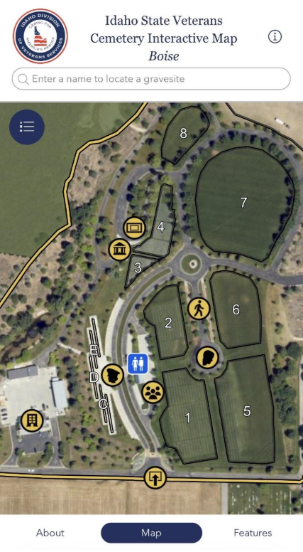
The image shows the mobile view. All functions remain the same as desktop.
Orion continues to refine the design and functionality in close collaboration with ISVC – Boise, ensuring the application is user-friendly and reliable. The launch of the new application is planned for early 2026, marking a significant step forward in enhancing the visitor experience at the ISVC – Boise. Looking ahead, there are plans to expand the application to include the ISVC – Blackfoot, supporting a broader vision for the application’s use.
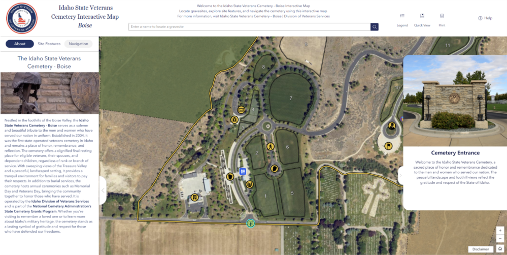
The image shows the new interactive map application in use on desktop. The sidebar on the left includes tabs containing information about the cemetery, a site features menu for zooming to and expanding pop-ups (displayed on the right), and a navigation tool that guides users between features across the cemetery.
Select the photo to visit the interactive map.
